|
Cedar Creek [ back ] |
|
| Location: | Boone/Callaway County |
| Difficulty: | Class I-II |
| Put-in/Take-out: |
0 = Rutherford Bridge 3.5 = Devils Backbone 9.5 = Route Y |
| Gauge: | No good gauge that everyone agrees on. (for me, standing on Rutherford Bridge looking below river left (south) there is a rock shelf. If the rocks below the shelf are covered, it is run-able) Basically, if the creek is running bank to bank with A LOT of volume, it's run-able. |
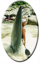
| Description: | Cedar Creek divides Callaway County and Boone County and cuts through Mark Twain National Forest. It is very similar to southern Missouri float streams scenery wise, but without the spring-fed water, it is rain dependent. Some small waves are present at low levels, but at flood, this Creek becomes really fun. It is a much larger volume creek than others in the Columbia area, however strainers are still a concern. One season an entire left chute around an island was jammed with large trees forcing the water under and around to the right. Not a place to get trapped! |